information
Project Fact Sheet
Please take a moment to review the Project Fact Sheet. You can find information about the project study, project cost, the proposed ADA guideline improvements, and additional project information in the section below, and in this document.
Project Fact Sheet (PDF) 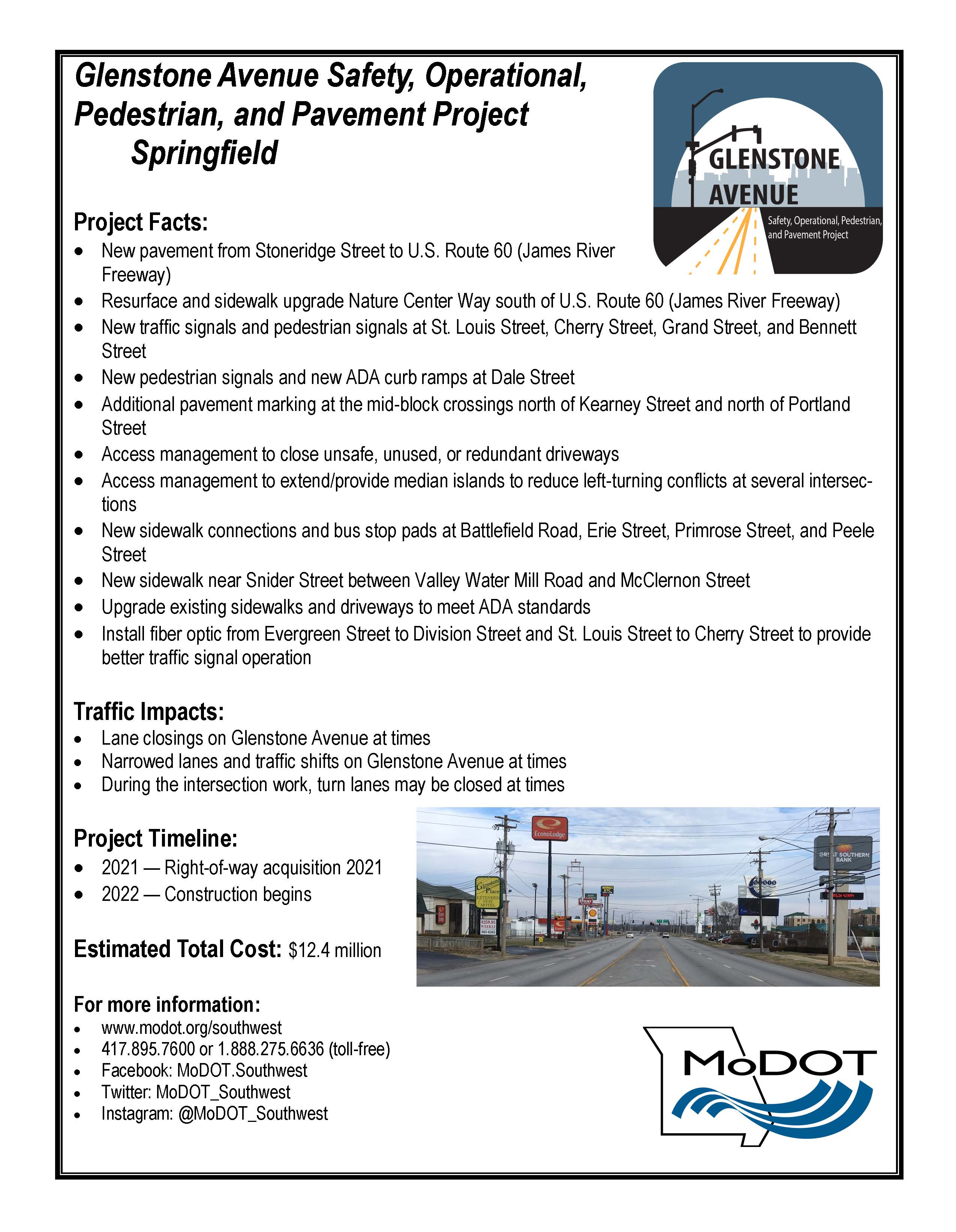
Fact Sheet Information
Project Limits: Route H/Glenstone Ave. from Stoneridge St. to Rte. 60 (James River Freeway)
Project Timeline: Right-of-way acquisition occurs in 2021. Construction begins in 2022.
Estimated Project Cost: $12.4 million
Additional Project Facts:
-
New pavement from Stoneridge Street to U.S. Route 60 (James River Freeway).
-
Resurface and sidewalk upgrade Nature Center Way south of U.S. Route 60 (James River Freeway).
-
New traffic signals and pedestrian signals at St. Louis Street, Cherry Street, Grand Street, and Bennett Street.
-
New pedestrian signals and new ADA curb ramps at Dale Street.
-
Additional pavement marking at the mid-block crossings north of Kearney Street and north of Portland Street.
-
Access management to close unsafe, unused, or redundant driveways.
-
Access management to extend/provide median islands to reduce left-turning conflicts at several intersections.
-
New sidewalk connections and bus stop pads at Battlefield Road, Erie Street, Primrose Street, and Peele Street.
-
New sidewalk near Snider Street between Valley Water Mill Road and McClernon Street.
-
Upgrade existing sidewalks and driveways to meet ADA standards.
-
Install fiber optic from Evergreen Street to Division Street and St. Louis Street to Cherry Street to provide better traffic signal operation.
Traffic Impacts:
-
Lane closings on Glenstone Avenue at times.
-
Narrowed lanes and traffic shifts on Glenstone Avenue at times.
-
During the intersection work, turn lanes may be closed at times.
For more information on the project, please utilize the following resources:
- modot.org/southwest
- Call MoDOT at 417-895-7600 or 1-888-275-6636 (toll-free)
- Facebook: MoDOT.Southwest
- Twitter: MoDOT_Southwest
- Instagram: @MoDOT_Southwest
- Email: swcr@modot.mo.gov